Property Details
Property Description
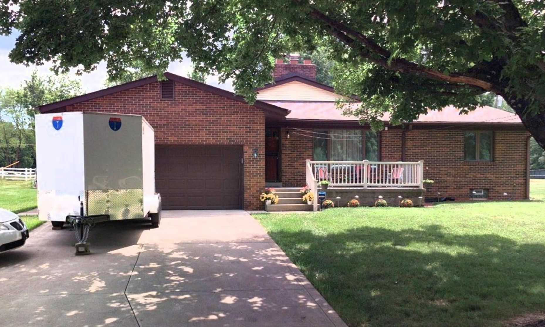
Subject property is a 4 BR / 1.50 BA Single Family Home w/ 2 Car Garage, containing 2,208 Sq Ft +/- built in 1953. Parcel number: . Minimum Bid $ 360,000.00 . All auction end Wednesdays at 1PM. 5% buyer's premium will apply over and above high bid. Please read terms and conditions for details related to purchasing foreclosure property. Interior showings are not available. To earn a commission, Buyer referrals must be made to Auctioneer before prospective buyers make any contact with Auctioneer or register for bidding. Use link: https://www.gryphonusa.com/broker-acknowledgement-form/ This is a foreclosure situation. Property being offered by Private Selling Officer per the authorities granted in Ohio Revised Code 2329.152 . Information available has come from public sources and is believed to be accurate but is not guaranteed. Buyers should conduct their own due diligence before bidding. List Agent has not physically viewed the property. Due to the nature of the sale, interior inspections are not allowed. Cash sale only. The auction is subject to postponement and cancellation. No financing.
Legal Description
Situated in the Township of Blendon, County of Franklin and State of Ohio: Tract One of Two: Being in Section 1, Township 2, Range 17, United States Military Lands, and being a part of the Bernice L. Groves 17.19 acre tract, deed for which is recorded in Deed Book 1939, page 447, Recorder's Office, Franklin County, Ohio, and further being more particularly bounded and described as follows: Commencing at a nail set at the Southwest corner of said 17.19 acre tract, said point being in the former centerline of Cubbage Road, as said centerline is shown as the existing centerline on Sheet 39 of the Right-of-Way Plans of the Franklin County Engineer of Cubbage Road, Township Road No. 188. Thence North 3 deg. 20 min. East, along the said former centerline of Cubbage Road, said line also being the westerly line of said 17.19 acre tract, a distance of 565.00 feet to a nail marking the real point of beginning of this description: Thence North 3 deg. 20 min. East, continuing along said former centerline of Cubbage Road, a distance of 165.00 feet to a nail; thence South 86 deg. 40 min. East, along a line drawn at right angles to the said centerline of Cubbage Road, passing an iron pin set in the present easterly Right-of-Way line of Cubbage Road, 50.0 feet, a total distance of 265.00 feet to an iron pin; thence South 3 deg. 20 min. West, along a line drawn parallel to and 265.0 feet easterly of measured at right angles, the said centerline of Cubbage Road, a distance of 165.00 feet to an iron pin; thence North 86 deg. 40 min. West along a line drawn at right angles to the said centerline of Cubbage Road, passing an iron pin at 215.00 feet, a total distance of 265.00 feet to the point of beginning. Containing 1.004 acres of land, but subject to all legal highways, highway easements, and other easements of record. Tract Two of Two: Situated in Quarter Township 1, Township 2, North, Range 17 West, United States Military Lands, in the Township of Blendon, County of Franklin, State of Ohio, and being a portion of a 5.702 acre tract of land conveyed as "Parcel G" to Nelle R. Hutchison (1/2 interest), William G. Hutchison (1/8 interest), Jennie Clark (1/8 interest), John Hutchison (1/8 interest) and Samual R. Hutchison (1/8 interest) by Deeds of Record in Deed Book 2410, page 509, and Deed Book 3494, page 427, Recorder's Office, Franklin County, Ohio, and bounded and described as follows: Beginning at an iron pin in the West line of said Parcel G. at the southeast corner of a 1.004 acre tract of land conveyed to Albert R. and Lucille J. Fagan by deed of record in Deed Book 3231, page 214, Recorder's Office, Franklin County, Ohio, and at the northeast corner of a 1.034 acre tract of land conveyed to Guenter and Ilse Berthold by deed of record in Deed Book 2615, page 229, Recorder's Office, Franklin County, Ohio, said iron pin being South 86 deg. 40 min. East a distance of 265.00 feet by the perpendicular measurement from a point at the southwest corner of said 1.004 acre tract, at the northwest corner of said 1.034 acre tract and in the former centerline of Cubbage Road; Thence North 3 deg. 20 min. East along a portion of the west line of said Parcel G. and along the east line of said 1.004 acre tract a distance of 165.00 feet to an iron pin at the northeast corner of said 1.004 acre tract and at the southeast corner of a 1.011 acre tract of land conveyed to Richard O. and Mary Ann Gibson by deed of record in Deed Book 2322, page 451, Recorder's Office, Franklin County, Ohio; Thence South 86 deg. 40 min. East along the north line extended easterly of said 1.004 acre tract and along the south line extended easterly of said 1.011 acre tract a distance of 264.00 feet to an iron pin; Thence South 3 deg. 20 min. West parallel with the east line of said 1.004 acre tract a distance of 165.00 feet to an iron pin in the south line extended easterly of said 1.004 acre tract and in the north line extended easterly of said 1.034 acre tract; Thence North 86 deg. 40 min. West along the south line extended easterly of said 1.004 acre tract and along the north line extended easterly of said 1.034 acre tract a distance of 264.00 feet to the place of beginning; Containing 1.000 acre of land, more or less, and being subject to all easements and restrictions of record.
Location
Foreclosure Details
Conditions of Sale
Auction By
